Severe Weather Outlook An area of low pressure will move northeast into the Tennessee Valley while a cold front stretching south of this low will move through the region this afternoon
5:00am ET - February 12, 2024 Severe Weather Outlook
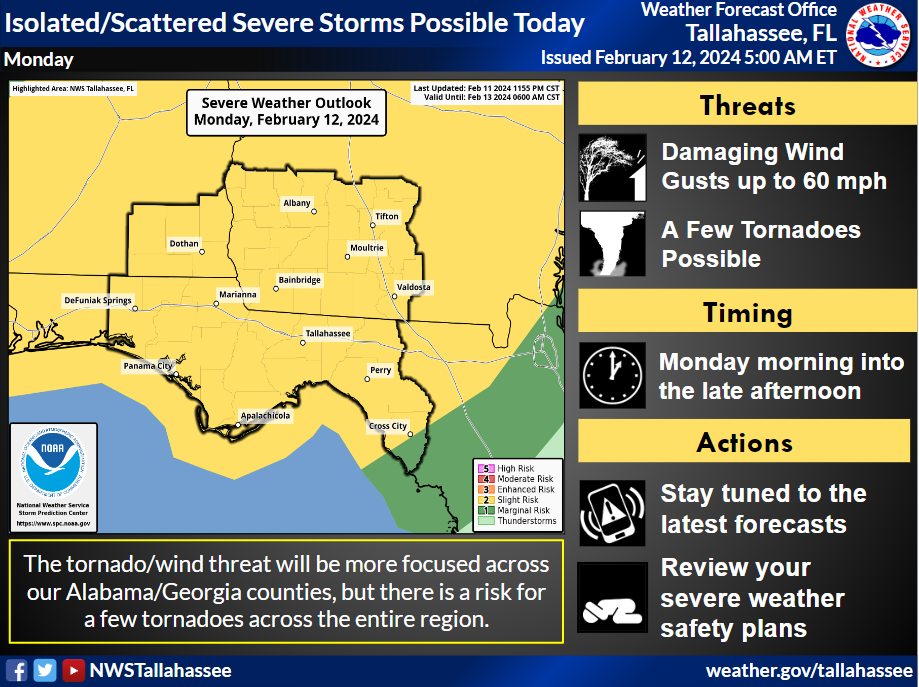
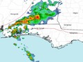
An area of low pressure will move northeast into the Tennessee Valley while a cold front stretching south of this low will move through the region this afternoon. Ahead of this cold front, widespread rain and thunderstorms are expected across southwest Georgia and Southeast Alabama where a warm front will linger, while storm coverage will be more scattered across the Florida counties.
The main concerns with storms this morning and into the afternoon will be the potential for damaging wind gusts up to 60 mph and possibly a few tornadoes. The severe threat for this system will be more scattered and the specific timing of the severe threat is more challenging as storms will likely not be focused on a squall line, but rather along and ahead of the primary cold front. The tornado threat will likely be focused across our Alabama/Georgia counties, where low-level shear along/near the front warm will be greater, but a tornado risk across our Florida counties still exists as well so dont let your guard down in Florida.
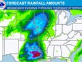
In addition to the severe threat, the potential for training storms along a slow, northward moving, warm front in southeast Alabama and southwest Georgia could lead to a slight risk for flash flooding (level 2 of 4). This threat will be highest north of a Tifton-Albany-Blakely-Enterprise line. While widespread rainfall amounts across the region will be 1 to 1.5 inches through this evening, amounts along and to the north of the warm front in the slight risk area could approach 3 to 5 inches through the afternoon in localized areas.
Lastly, a coastal flooding threat (stretching from Indian Pass east to the Dixie/Levy county line) still remains possible with the high tide cycles early this morning, this evening, and possibly with the high tide cycle early Tuesday morning. Though the threat on Tuesday morning will likely be confined to eastern portions of the Apalachee Bay across Taylor/Dixie county. Model guidance has come down a little overnight and peak inundation with the high tide cycles will only be around 1 to 2 feet along the immediate coastline.


|
|

Weather searching weather forecast for all cities in the world.
The second option is to search through list of continents and countries.
