Severe Weather Outlook UPGRADED to Enhanced (Level 3 of 5). Here's an outline of the hazards we're expecting. Severe Weather: With increasing confidence in the potential severe threat
⚠ 4:00pm ET - Severe Weather Outlook UPGRADED to Enhanced (Level 3 of 5).
Here's an outline of the hazards we're expecting.
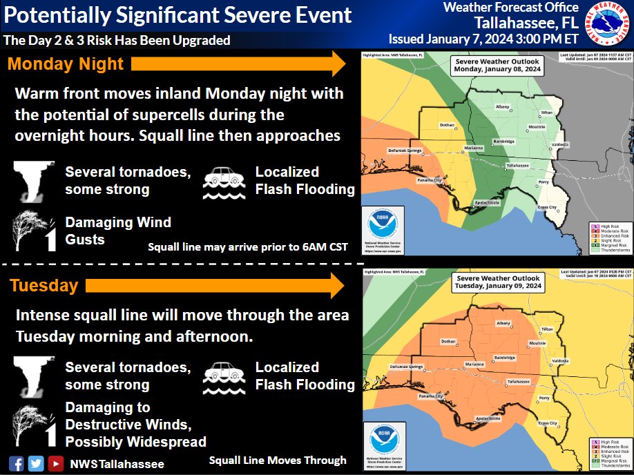
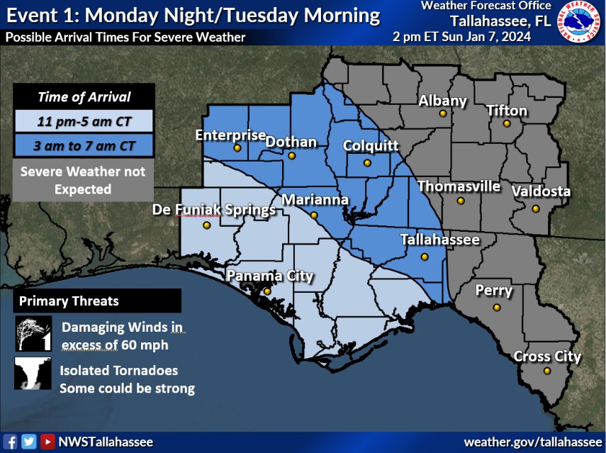
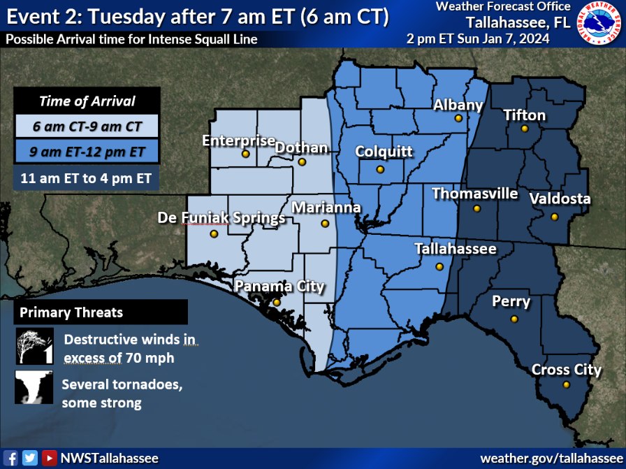
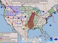
⛈️ Severe Weather: With increasing confidence in the potential severe threat, there is now an enhanced risk (level 3 of 5) of severe weather for Monday night into Tuesday morning/afternoon. There are likely to be 2 rounds of severe weather, one on Monday night into very early Tuesday. The second round will be Tuesday morning into afternoon along the primary squall line. With the afternoon update, there is increased confidence that these rounds could bring the potential for tornadoes and damaging winds. With the very strong wind fields, and wind shear with this event, there is the potential for destructive winds with the squall line, and possibly a few strong tornadoes.
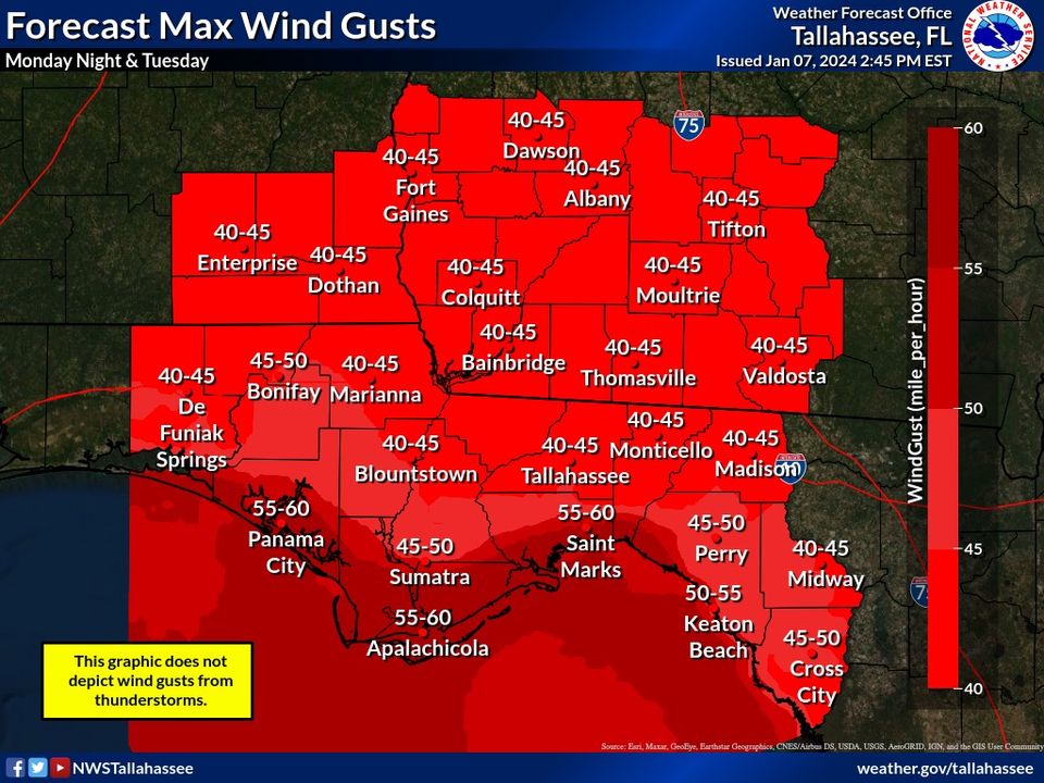
🌬️ Non-thunderstorm Winds: Damaging winds are also expected outside of storms. Most areas will see gusts of 40-55 mph, possibly up to 60 mph near the beaches. This could result in tree damage and power outages before strong to severe storms arrive.
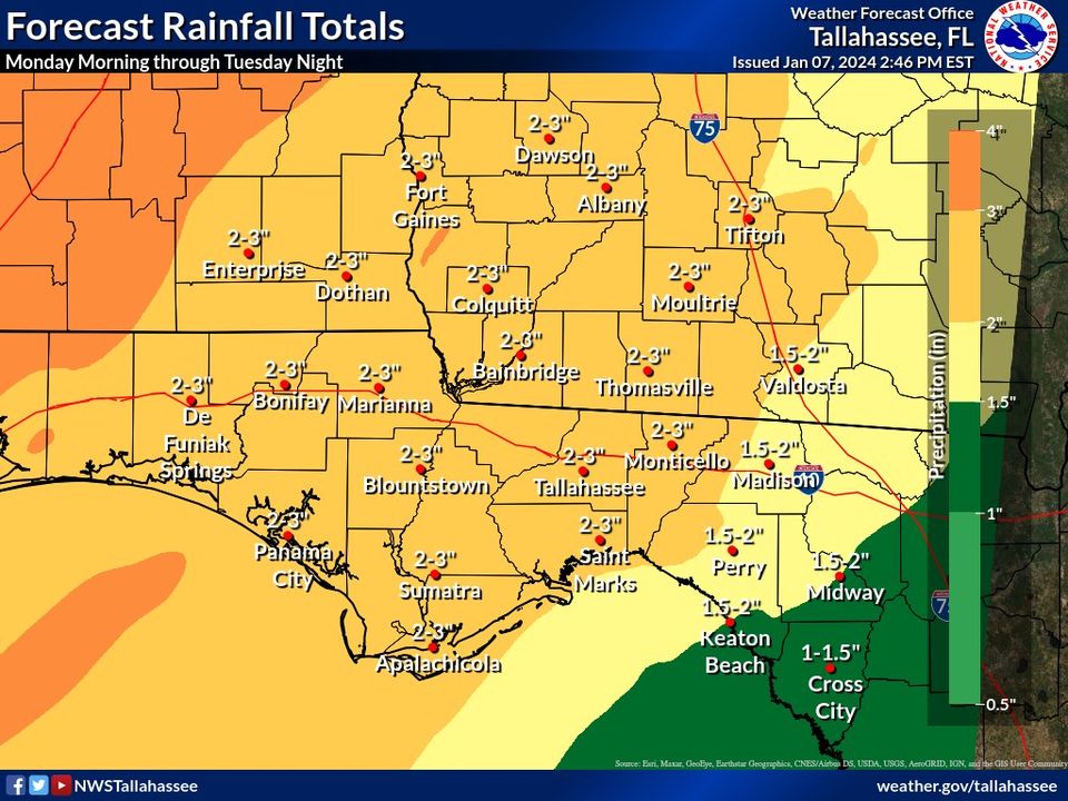
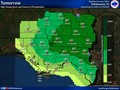
🌧️ Rainfall: Locally heavy rainfall remains possible with 2-4 inches expected. Some isolated totals of 4-6 inches are possible. This may result in some flash flooding. Rises on rivers are also possible given repeated rainfall events.
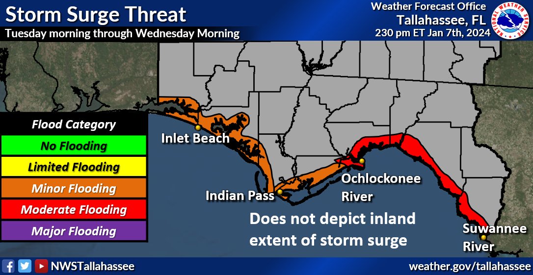
⛵️ Beach/Boating: Extremely dangerous beach and boating conditions are expected. Storm and Gale Watches are in effect. Dangerous rip currents continue today through at least late this week with very high surf by Tuesday. Beach erosion & coastal flooding are also possible. The greater coastal flood threat will likely be across the Apalachee Bay, but the magnitude of the threat largely is largely determined when the squall line pushes through.
Now is the time to prepare for this event. Check your supplies. Ensure you have multiple ways to get warnings that will wake you up. Secure any outdoor items. Keep devices charged BEFORE Monday night. With the strong winds advertised before the severe threat, there could be power outages well in advance of the severe threat. We'll have more information and better refined forecasts as we get closer to the event.
|
|

Weather searching weather forecast for all cities in the world.
The second option is to search through list of continents and countries.
