11am UPDATE August 29, 2023 for #Idalia from the NWS in Tallahassee and the National Hurricane Center.
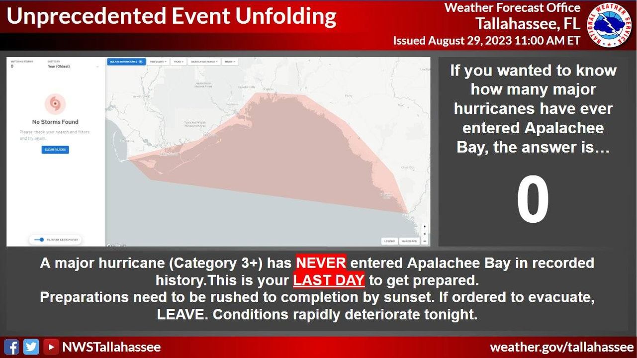
Hurricane Idalia will likely be an unprecedented event for many locations in the Florida Big Bend. Looking back through recorded history, NO major hurricanes have ever moved through the Apalachee Bay. When you try to compare this storm to others, DON'T. No one has seen this.
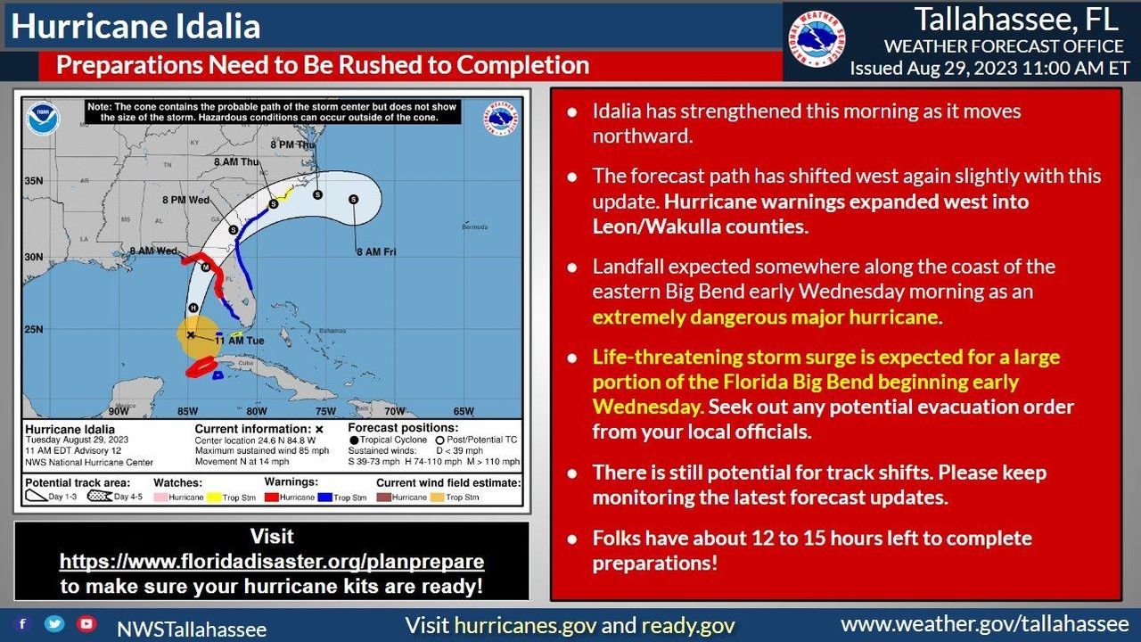
Idalia is strengthening and rapid intensification is still forecast to occur today and into landfall sometime Wednesday morning. A slight west shift in the track did occur but users are reminded to not focus on the center, impacts will occur over a large area.
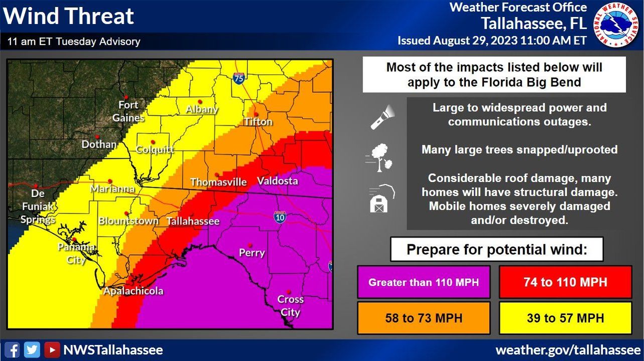
Every storm brings different impacts and Idalia is no exception. Here is what you should be prepared for in terms of the wind threat. Strongest winds are likely beginning early Wednesday morning, spreading inland through the day. You have less than 15 hours to finish prep.
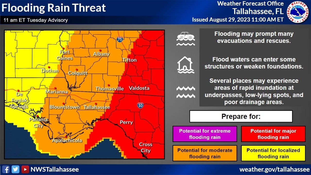
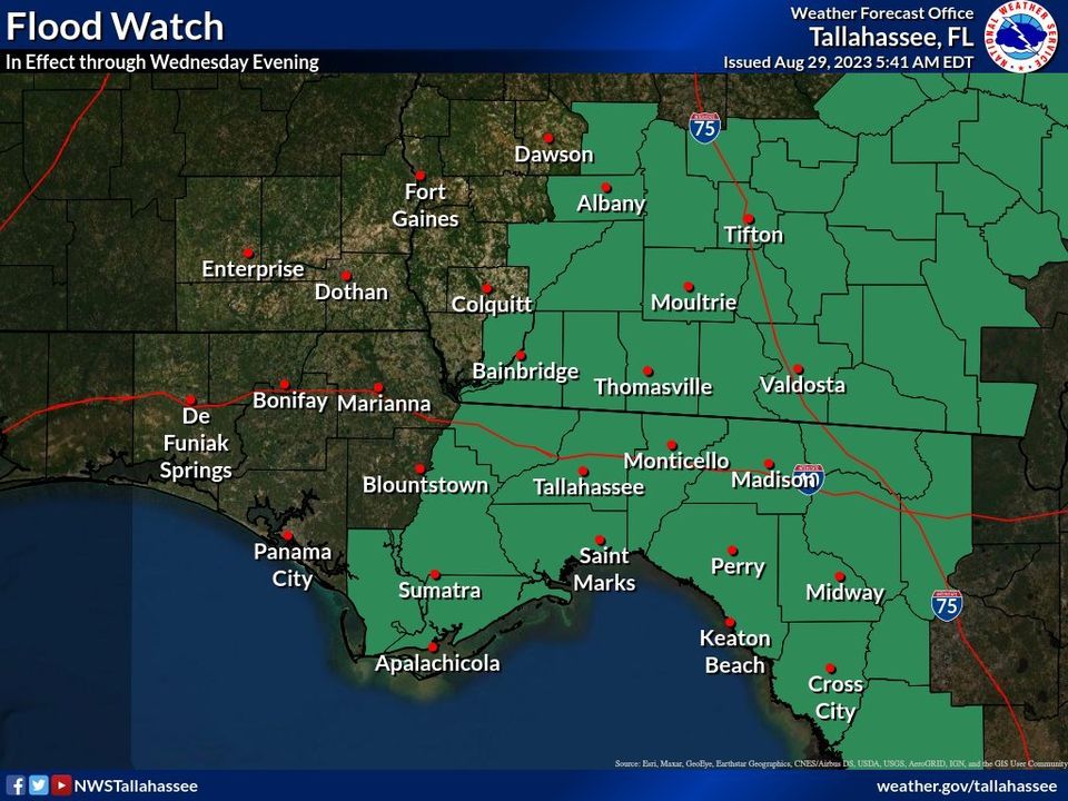
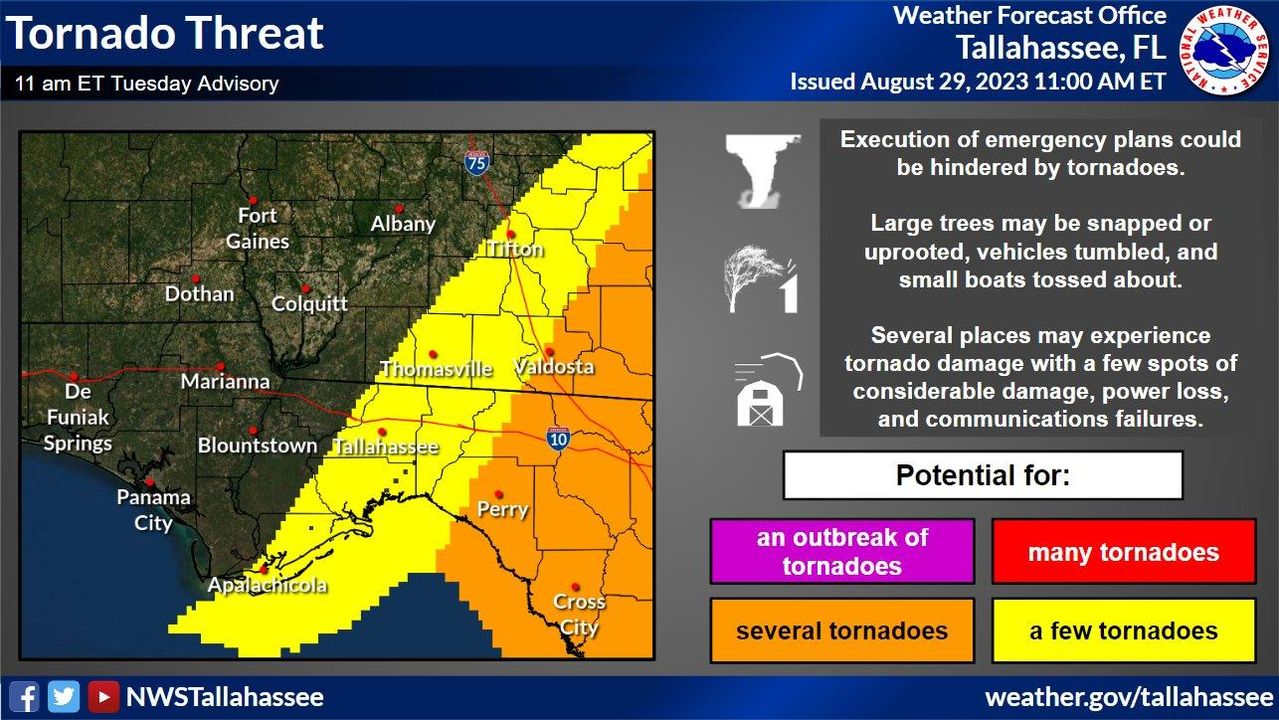
Heavy rainfall and the potential for tornadoes are forecast as well. The threats for these hazards will be greatest generally along and east of where Idalia will travel. Rain begins to move in tonight and the tornado threat will increase early Wednesday morning.
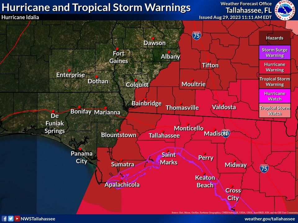
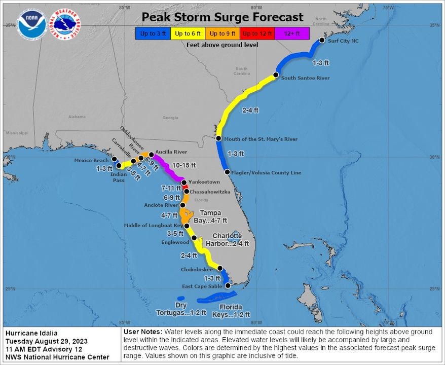
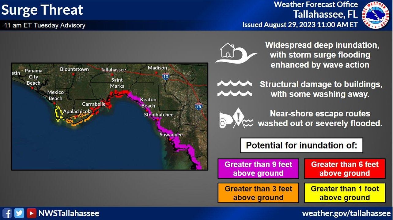
Finally the surge threat. If you are ordered to evacuate, do NOT take that order lightly. Life threatening surge will begin to develop later tonight and especially on Wednesday morning and afternoon as Idalia moves in. These values will likely make escape routes impassable.
#FLwx #GAwx #ALwx
We'll have a Facebook Live around 1:00pm ET to discuss some of these changes and possibly take your questions if we have time.
Images
Hurricane #Idalia will likely be an unprecedented event for many locations in the Florida
Big Bend. Looking back through recorded history, NO major hurricanes have ever moved through the Apalachee
Bay. When you
try to compare this
storm to others, DON'T. No one
has seen this.
#Idalia is strengthening and
rapid intensification is still forecast to occur today and into landfall sometime Wednesday morning. A slight west
shift in the track did occur but users
are reminded to not
focus on the center, impacts will occur over a large area. #FLwx #ALwx #GAwx
#Idalia is strengthening and
rapid intensification is still forecast to occur today and into landfall sometime Wednesday morning. A slight west
shift in the track did occur but users
are reminded to not
focus on the center, impacts will occur over a large area. #FLwx #ALwx #GAwx
Every
storm brings different impacts and #Idalia is no exception. Here is what you should be prepared for in terms of the wind threat. Strongest winds
are likely beginning early Wednesday morning, spreading inland through the day. You have less than 15 hours to finish prep.
Finally the surge threat. If you
are ordered to evacuate, do NOT take that order lightly.
Life threatening surge will begin to develop later tonight and especially on Wednesday morning/afternoon as #Idalia moves in. These values will likely make escape routes impassable. #FLwx
Finally the surge threat. If you
are ordered to evacuate, do NOT take that order lightly.
Life threatening surge will begin to develop later tonight and especially on Wednesday morning/afternoon as #Idalia moves in. These values will likely make escape routes impassable. #FLwx
Heavy rainfall is forecast as
well. The threats for these hazards will be greatest generally along and east of where #Idalia will travel. Rain begins to move in tonight and pick up in intensity Wednesday morning and afternoon. #FLwx #ALwx #GAwx
Heavy rainfall is forecast as
well. The threats for these hazards will be greatest generally along and east of where #Idalia will travel. Rain begins to move in tonight and pick up in intensity Wednesday morning and afternoon. #FLwx #ALwx #GAwx
The potential for tornadoes
are forecast as
well. The threats for these hazards will be greatest generally along and east of where #Idalia will travel. The
tornado threat will increase early Wed morning. #FLwx #ALwx #GAwx
