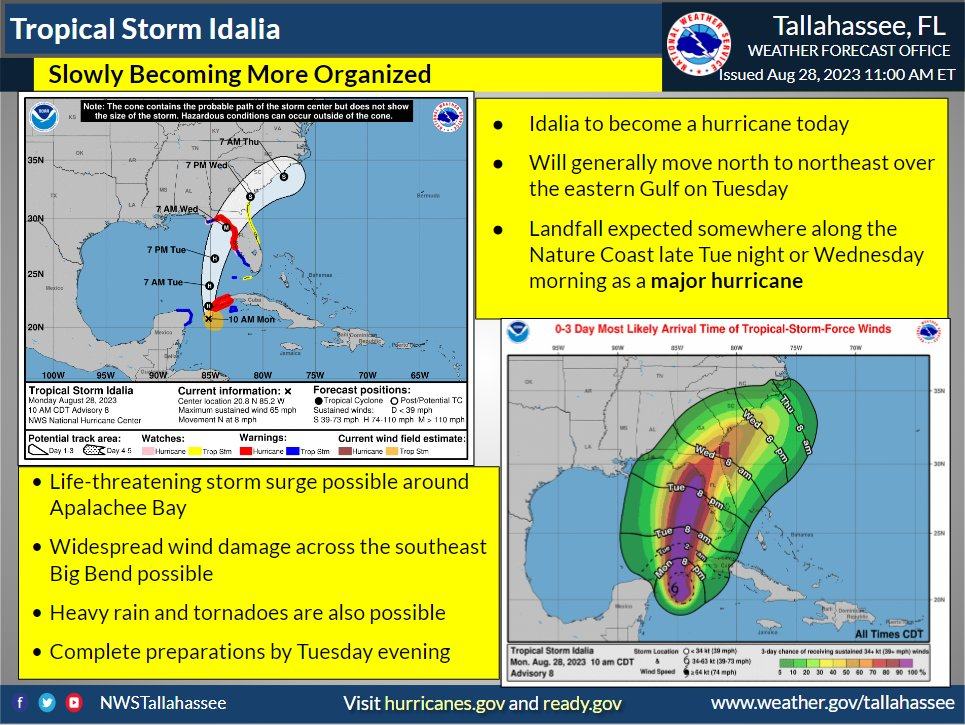
Idalia remains a tropical storm, and aside from a slight westward shift in the forecast track, most of the forecast remains the same - Update from the National Hurricane Center
August 28th 11am Advisory
11am Aug 28th - Update from the National Hurricane Center. #Idalia remains a tropical storm, and aside from a slight westward shift in the forecast track, most of the forecast remains the same. It is now starting to move north and rapid strengthening is expected on Tuesday.
Preparations along the Panhandle and Big Bend need to be started today if you have not begun. Additionally, impacts will be felt well beyond the center of the storm so it's not the time to let your guard down despite any forecast changes from 24 hours ago.
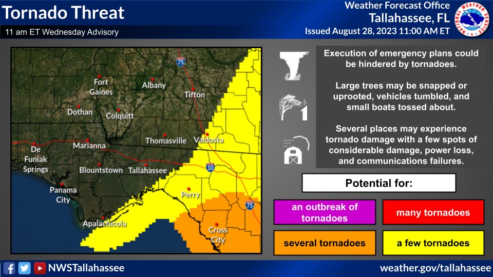
Main impacts will begin late Tuesday night with the main event being on Wednesday. Preparations should be complete by Tuesday evening as rain and tornado potential should begin to increase by that time across the area.
The wind and storm surge will be the most significant impacts from #Idalia. The storm surge impacts will be significant and life threatening. Listen to the advice of emergency management. If ordered to evacuate, follow their instructions. Doing so, could save your life.
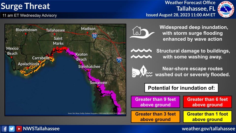
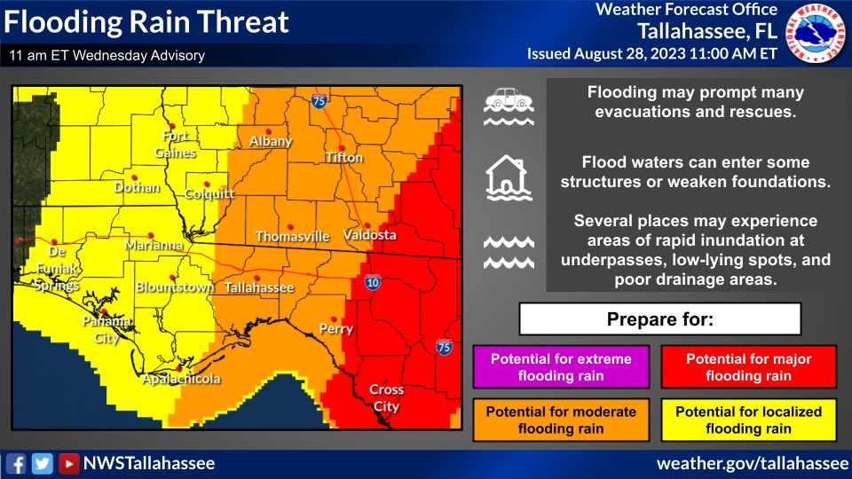
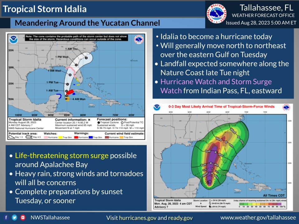
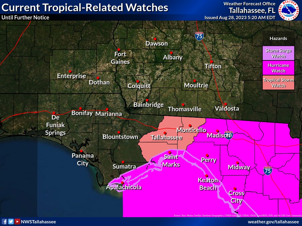
8/28 5am ET: Idalia is forecast to be a major hurricane over the eastern Gulf of Mexico. Hurricane Watches have been expanded to Madison County. Tropical Storm Watches now in effect for Leon, inland Jefferson, and inland Wakulla Counties. Finish your preparations by Tuesday.
